8 Detailed Kilimanjaro Mountain Map Routes for Every Climber Profile
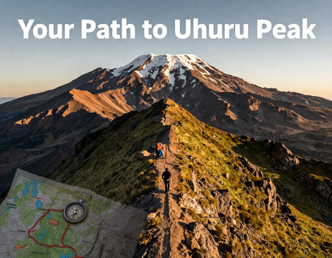
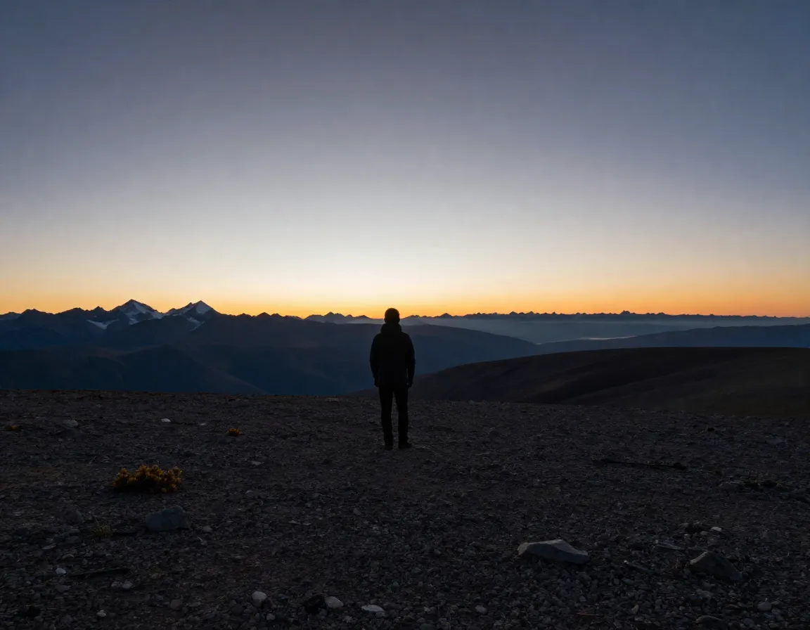
Imagine standing at Uhuru Peak — 5,895 meters above sea level — with all of Africa beneath your feet. That dream is closer than you think, but only if you choose the right path to get there. With 8 Detailed Kilimanjaro Mountain Map Routes for Every Climber Profile to consider, picking the wrong one can mean the difference between a triumphant summit and a painful retreat. Whether you’re a first-time trekker or a seasoned mountaineer, this guide breaks down every route so you can match your skills, timeline, and goals to the perfect trail.
Disclosure: This post contains affiliate links. As an Amazon Associate, we earn from qualifying purchases, and at no extra cost to you.
Key Takeaways
- 🗺️ Seven official ascent routes exist on Kilimanjaro, all leading to Uhuru Peak on Kibo’s crater rim.
- 🏆 Lemosho and Northern Circuit offer the highest success rates (~90%+) due to superior acclimatization profiles.
- ⏱️ Route duration matters — longer routes mean better altitude adjustment and a higher chance of summiting.
- 🎯 Your climber profile (fitness level, experience, budget, and time) should drive your route choice.
- ⬇️ Descent routes are assigned by park authorities — you cannot freely choose your own way down.
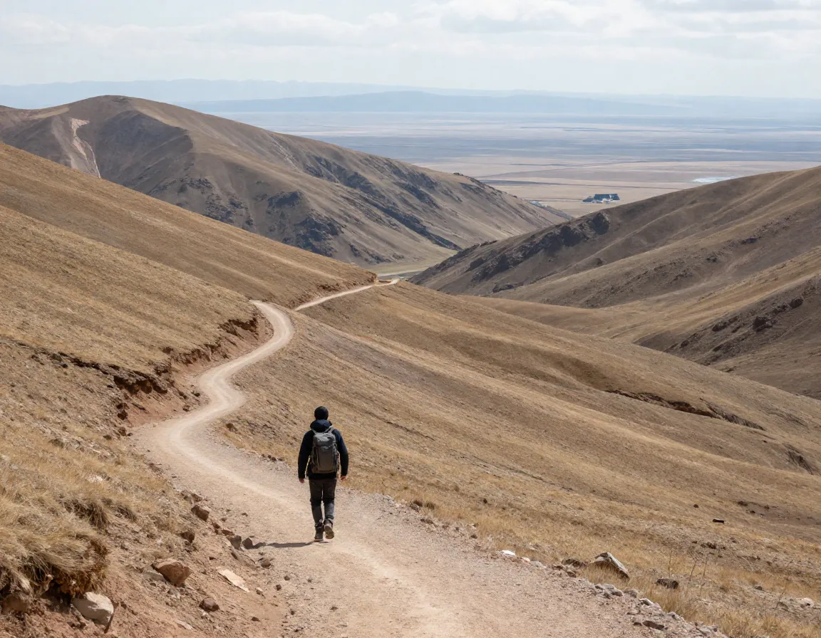
Understanding the Kilimanjaro Mountain Map Before You Climb
Before diving into the 8 Detailed Kilimanjaro Mountain Map Routes for Every Climber Profile, it helps to understand how the mountain is structured. Kilimanjaro has three volcanic cones: Kibo (the highest), Mawenzi, and Shira. All official routes converge at Kibo’s crater rim, where Uhuru Peak sits.
“Choosing the right Kilimanjaro route isn’t just about difficulty — it’s about matching the mountain to the person climbing it.”
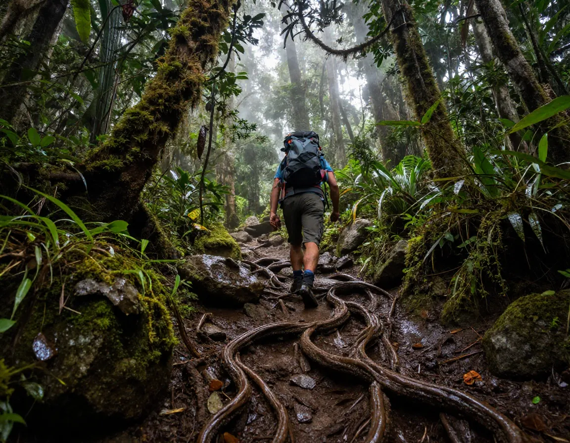
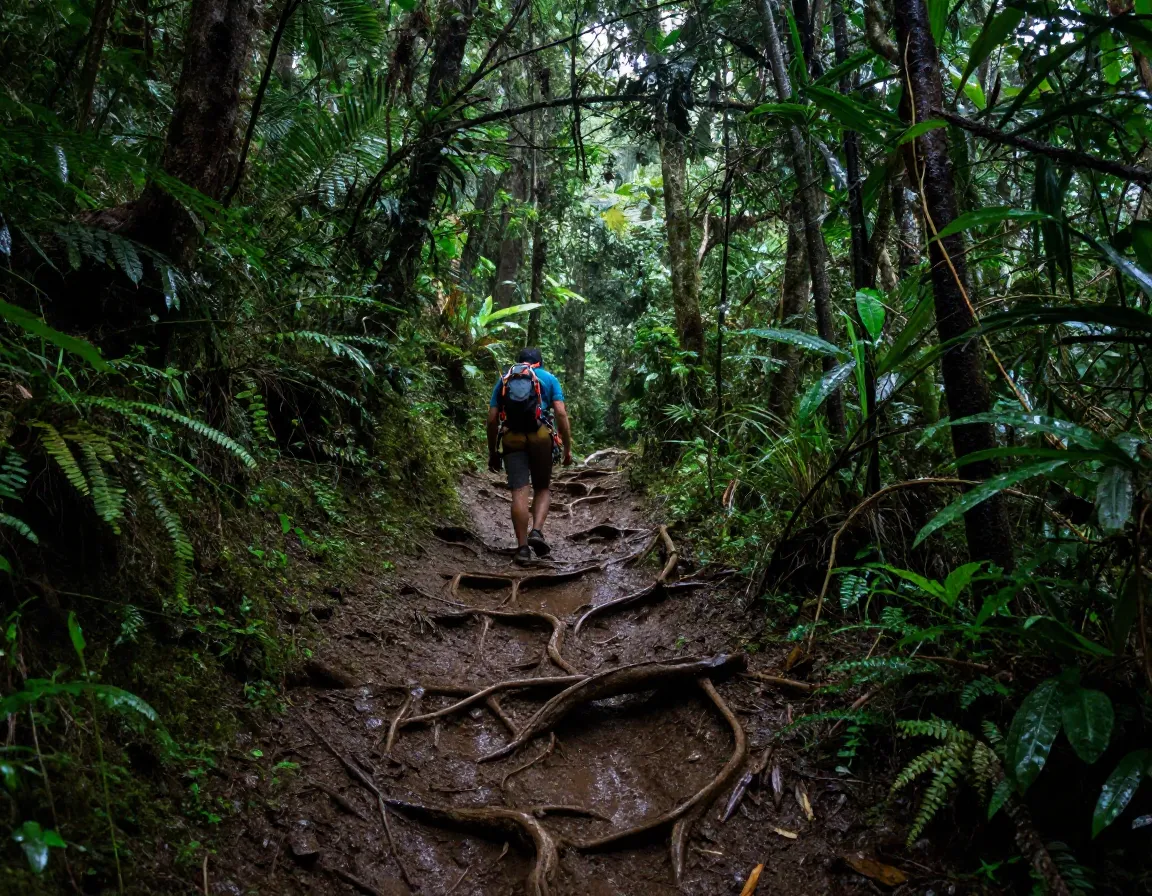
The mountain passes through five distinct climate zones: cultivated farmland, rainforest, heath and moorland, alpine desert, and arctic summit. Your route determines how much time you spend in each zone — and how well your body adapts to the altitude.
Key facts to know:
- Kilimanjaro sits in Tanzania, East Africa
- Uhuru Peak elevation: 5,895 m (19,341 ft)
- Park entry requires a licensed guide
- Descent routes are regulated — most climbers descend via the Mweka Route
The 8 Detailed Kilimanjaro Mountain Map Routes for Every Climber Profile
Here is a quick comparison table before we go deeper:
| Route | Duration | Difficulty | Success Rate | Best For |
|---|---|---|---|---|
| Marangu | 5–6 days | Easy–Moderate | ~65% | Budget travelers |
| Machame | 6–7 days | Moderate–Hard | ~85% | Fit hikers |
| Lemosho | 7–8 days | Moderate | ~90% | Scenic seekers |
| Rongai | 6–7 days | Easy–Moderate | ~80% | Solo travelers |
| Northern Circuit | 9–10 days | Moderate | 90%+ | Best acclimatization |
| Shira | 7–8 days | Moderate–Hard | ~85% | Experienced trekkers |
| Umbwe | 5–6 days | Very Hard | ~60% | Expert climbers |
| Mweka | Descent only | N/A | N/A | All routes (down) |
1. Marangu Route — The “Coca-Cola Route”

Best for: Budget-conscious climbers and beginners
Duration: 5–6 days | Difficulty: Easy to Moderate
The Marangu Route is used by approximately 40% of all Kilimanjaro climbers, making it the most trafficked path on the mountain. It is the only route with hut accommodation, which means you sleep in bunk-style dormitories rather than tents. This appeals to climbers who prefer a bit more comfort.
However, the shorter itinerary limits acclimatization time, which is why its success rate sits around 65% — lower than most other routes. The trail approaches from the southeast and follows a relatively gradual gradient.
Pros: Hut accommodation, lower cost, straightforward trail
Cons: Crowded, poor acclimatization profile, lower summit success rate
2. Machame Route — The “Whiskey Route”
Best for: Fit, experienced hikers who want a challenge
Duration: 6–7 days | Difficulty: Moderate to Hard
The Machame Route is Kilimanjaro’s most popular trail, used by 35–41% of all climbers. Its nickname — the “Whiskey Route” — reflects its tougher terrain compared to the easier “Coca-Cola” Marangu. The path approaches from the southwest, offering dramatic scenery through dense rainforest and open moorland.
The 7-day version is strongly recommended over the 6-day option. The extra day improves acclimatization significantly and pushes the success rate to approximately 85%.
Pros: Stunning scenery, good acclimatization, high success rate
Cons: Very crowded, physically demanding
3. Lemosho Route — The Scenic Champion
Best for: Climbers who want beauty AND a high success rate
Duration: 7–8 days | Difficulty: Moderate
Many guides — including myself — consider the Lemosho Route the finest experience on the mountain. It approaches from the western slope, offering remote wilderness in the early days before joining the Machame Route near Lava Tower. Its ~90% success rate is among the best on the mountain.
The longer duration allows your body to adjust gradually to altitude. You’ll pass through pristine rainforest, wide moorlands, and stunning ridge walks with views of both Kibo and Mawenzi.
Pros: Best scenery, excellent acclimatization, high success rate, fewer crowds early on
Cons: Higher cost, longer time commitment
4. Rongai Route — The Easiest Path
Best for: Solo travelers, beginners, and those visiting during rainy season
Duration: 6–7 days | Difficulty: Easy to Moderate
The Rongai Route is rated the easiest route on Kilimanjaro. It approaches from the north, near the Kenyan border, and offers a completely different perspective of the mountain — including unique views of Mawenzi Peak, Kilimanjaro’s dramatic second summit.
Because it approaches from the dry northern side, Rongai is an excellent choice during the rainy season (April–May). Crowds are lighter here, making it a peaceful option.
Pros: Less crowded, good for rainy season, easiest gradient
Cons: Less scenic variety, descent via Marangu can feel anticlimactic
5. Northern Circuit Route — The Ultimate Acclimatization Route
Best for: Climbers who want the best chance of summiting
Duration: 9–10 days | Difficulty: Moderate | Distance: 98 km
The Northern Circuit is Kilimanjaro’s newest and longest route. At 98 kilometers, it circles almost the entire mountain before ascending to the summit. This extended journey delivers 360-degree panoramic views that no other route can match.
More importantly, the slow, gradual ascent profile gives your body maximum time to acclimatize. The result? A summit success rate of 90% or higher. Crowd levels are extremely low, making this a premium, peaceful experience.
“If time is not a constraint, the Northern Circuit is simply the best route on the mountain — period.”
Pros: Best acclimatization, highest success rate, 360-degree views, fewest crowds
Cons: Expensive, requires 9–10 days, limited operator availability
6. Shira Route — The High-Altitude Starter
Best for: Experienced trekkers comfortable with high starting elevations
Duration: 7–8 days | Difficulty: Moderate to Hard
The Shira Route starts at the highest trailhead elevation of any Kilimanjaro route, beginning on the Shira Plateau at around 3,500 m. This can be a disadvantage — the rapid gain in altitude on day one increases the risk of altitude sickness before your body has adjusted.
The route shares much of its path with the Lemosho Route after the first day or two, approaching from the western slope. It offers similar scenery but with a more demanding opening.
Pros: Remote start, dramatic plateau scenery, merges with Lemosho’s best sections
Cons: Rapid initial altitude gain, higher AMS risk, requires strong fitness
7. Umbwe Route — For Expert Climbers Only

Best for: Experienced mountaineers seeking a serious challenge
Duration: 5–6 days | Difficulty: Very Hard
The Umbwe Route is the shortest, steepest, and most demanding path on Kilimanjaro. It ascends directly and aggressively from the south, with very little time for acclimatization. The success rate is approximately 60% — the lowest of any route.
Because of its extreme difficulty, virtually no casual climbers choose this path. It is reserved for those with significant high-altitude experience who want a raw, intense challenge.
Pros: Remote, uncrowded, dramatic terrain, fast ascent
Cons: Very low success rate, poor acclimatization, not suitable for most climbers
8. Mweka Route — The Standard Descent
Best for: All climbers (descent only)
Duration: 1–2 days (descent) | Difficulty: Moderate
The Mweka Route is not an ascent path — it is designated for descent only and is used by the majority of climbers who ascend via Machame, Lemosho, Shira, Umbwe, or Northern Circuit. Park authorities assign descent routes based on your ascent choice; you cannot freely select your own way down.
The Mweka trail drops steeply through moorland and rainforest back to Mweka Gate. It is a fast, efficient descent that typically takes 4–6 hours on the first descent day.
Pros: Direct, efficient descent, lush rainforest scenery
Cons: Steep and hard on knees, descent only
Choosing the Right Route for Your Climber Profile
Now that we’ve covered all 8 Detailed Kilimanjaro Mountain Map Routes for Every Climber Profile, here’s a quick decision guide:
- 🟢 First-time trekker on a budget? → Marangu Route
- 🟡 Fit hiker wanting a classic experience? → Machame Route
- 🌿 Scenic experience with high success rate? → Lemosho Route
- 🧭 Best overall acclimatization and success? → Northern Circuit
- 🌧️ Rainy season or solo traveler? → Rongai Route
- 🏔️ Expert mountaineer? → Umbwe Route
Conclusion
Kilimanjaro is one of the world’s most accessible high-altitude summits — but “accessible” doesn’t mean easy. In 2026, more climbers than ever are attempting Uhuru Peak, and route selection remains the single most important decision you’ll make before lacing up your boots.
Here are your actionable next steps:
- Assess your fitness and experience honestly before choosing a route.
- Prioritize acclimatization — choose a longer route if your schedule allows.
- Book with a licensed operator who knows the Kilimanjaro mountain map in detail.
- Train for at least 3–6 months before your climb, focusing on cardiovascular endurance and leg strength.
- Pack for all five climate zones — conditions change dramatically from base to summit.
The mountain is waiting. Choose your route wisely, prepare thoroughly, and Uhuru Peak will be yours. 🏔️
References
- Kilimanjaro National Park Authority. Official Route Information. Tanzania National Parks. 2019.
- Thomson Safaris. Kilimanjaro Routes Compared: Which Is Best for You? 2021.
- Kilimanjaro Adventures. Complete Guide to Kilimanjaro Climbing Routes. 2022.
- Ultimate Kilimanjaro. Kilimanjaro Routes Overview and Comparison. 2023.
- Climbing Kilimanjaro. Shira Route vs Lemosho Route: What’s the Difference? 2020.